Trail of the Coeur d'Alenes
Smelterville
Stock up on Food & Water
Restroom
Parking
Food
Shopping
Formerly the home to the Bunker Mine Smelting Complex, today Smelterville is a mix of residential, commercial and industrial areas.
Across the street from the Smelterville Trailhead are Dollar Tree and Grocery Outlet. Approximately a 1/2 mile to the west is Wal-Mart. These stores are the final opportunity to get snacks, bottled water and other supplies for the trail before reaching the town of Harrison 35.8 miles away. These are the largest and only “box stores” on the trail.
There is very limited, and sometimes no water on the trail after Smelterville, so it’s imperative to leave Smelterville with plenty of water.
Fun Fact about Smelterville
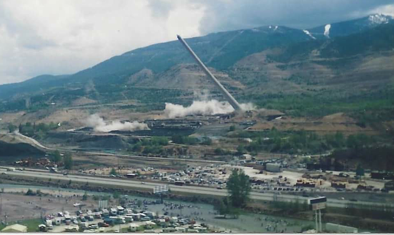
The town of Smelterville was named after the gigantic smelting towers that stood over the town for decades. On May 27, 1996 the smelters were blown up to great applause as part of the superfund cleanup of the Silver Valley. This paved the way for projects like the Trail of the Coeur D Alenes.

The Ride - Smelterville to Pinehurst
2.4 Miles
The ride from Smelterville to Pinehurst (Pine Creek Trailhead) is the final portion of the Trail that follows Interstate 90. With the exception of a quick underpass in Cataldo, you won’t see I-90 again on the ride.
This stretch takes you through commercial areas, industrial areas, and residential neighborhoods. Right before the town of Pinehurst the trail takes a turn north going under I-90. Because of this, the trail does not go through town. There is however a 2 mile connector trail that connects the Pine Creek Trailhead to downtown Pinehurst. The Pine Creek Trailhead is located approximately 200 ft after you cross underneath the Interstate.


