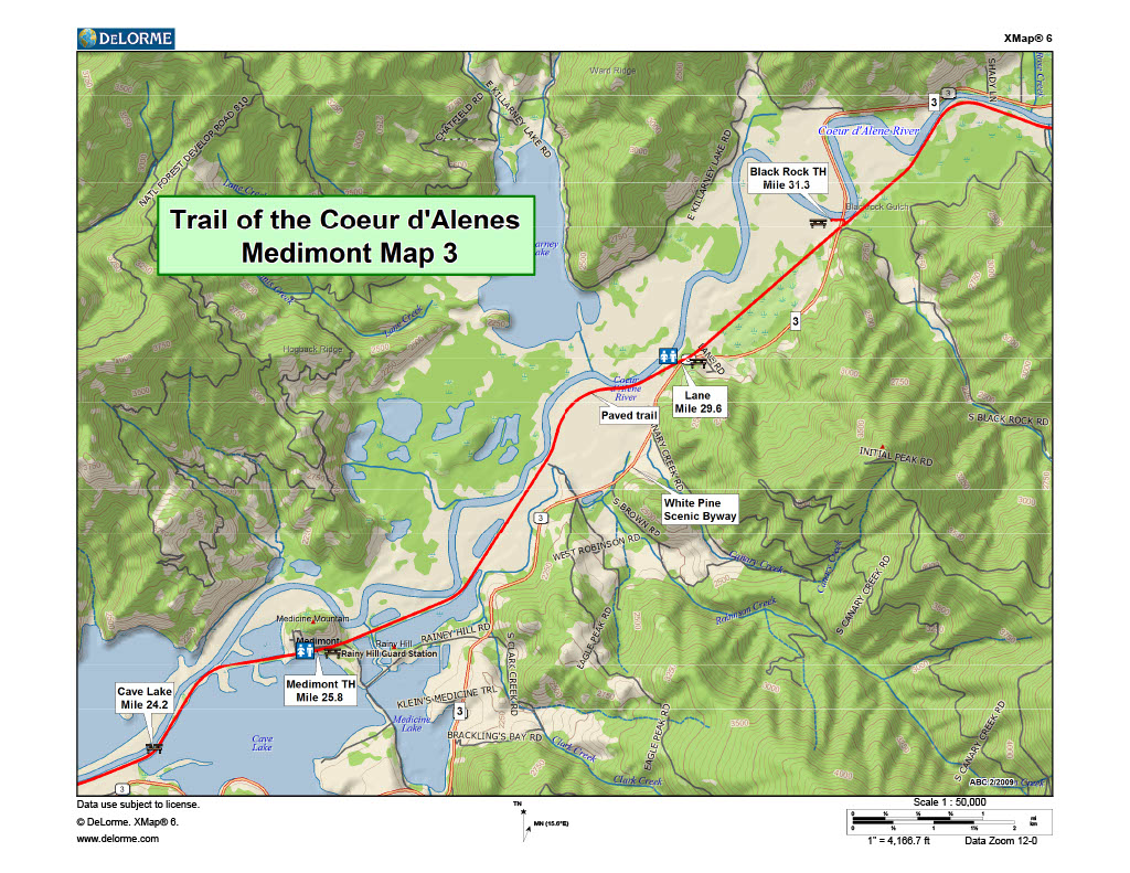
Trail of the Coeur d'Alenes
Black Rock Trailhead
20500 State Hwy 3, Cataldo, ID (Approximate)
Easy to Find
Parking
The Black Rock Trailhead is a small parking area with interpretive signs located on Hwy 3. The trail is very easy to find. The trailhead is located near the town of Rose Lake.
From I-90, take exit 34. Head south on Highway 3. The trailhead is located on the right hand side of the highway 3.2 miles south of the town of Rose Lake. Look for it right after you cross over the Coeur D Alene River bridge.
This trail has limited parking and is not recommended for large vehicles, RV’s or trailers. It is a dead end parking lot with limited turn around space.
(Note: Black Rock Trailhead is no longer a Cycle Haus Shuttle Stop. Please use Bull Run just a few miles away.)
Streetview: Black Rock Trailhead, Rose Lake ID
Google Map: Black Rock Trailhead, Rose Lake ID
The Ride - Black Rock to Medimont
5.5 Miles
The ride from Black Rock to Medimont is visually stunning. You are surrounded by large open fields, farms, and wetlands with forested hills and mountains in the background.
The wetlands are conducive to wildlife however the treed areas closer to the lakes, where animals feel protected, may be a better viewing area.
During the summer months this section of trail is in full sun and can be very warm. It’s important to prepare for this section by bringing plenty of water. Although the views are stunning, I recommend riding this section of trail straight through in the summer months until you reach the treed and cooler part of the trail near Medimont. On the other hand, if you’re riding in the Spring or Fall months, this warmer section may feel like a relief from the cool air near the hillsides and lakes.
At mile 29.6 is the Lane Wayside with restrooms and picnic tables.


